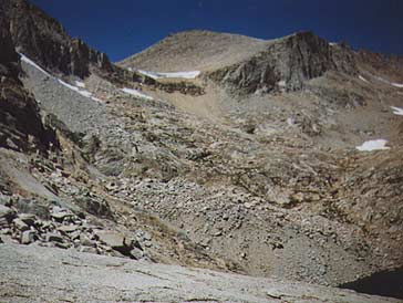
Looking towards the east side of Longley Pass (12,400+) from the ridge that divides the southern branch of the headwaters of Lake Reflection from the northern branch (this is on the route from Thunder Pass to Longley Pass). The picture was taken in mid August of a below normal snow year. The cornice is still blocking the pass. The cliff on the right side can be used to bypass the cornice. South Guard (13,224') can be seen be seen above the pass. Some guides claim that there is an old ducked trail from Lake Reflection to Longley Pass. However, in my times in this area I have yet to find much of anything resembling a trail of any sort except very near to of the pass. Map.
A marvelous account of the first recorded crossing of this pass can be found in the May 1985 issue of the Sierra Club Bulletin. In this article Howard Longley describes how he and five others along with a large amount of stock traveled from Horse Corral Meadows to Mt. Whitney via this pass and most likely crossed Harrison Pass (they named it Madary Pass).